
 Search
 Feedback
 About
About Help
Help News
News
| Listing 1 - 10 of 20 | << page >> |
Sort by
|
Book
ISBN: 9782735506873 Year: 2009 Publisher: Paris Éditions du CTHS
Abstract | Keywords | Export | Availability | Bookmark
 Loading...
Choose an application
- Reference Manager
- EndNote
- RefWorks (Direct export to RefWorks)
Cartography --- 912 <09> <44> --- Cartography, Primitive --- Chartography --- Map-making --- Mapmaking --- Mapping (Cartography) --- Mathematical geography --- Surveying --- Map projection --- Maps --- History --- Cartografie. Kaarten. Plattegronden. Atlassen--Geschiedenis van ...--Frankrijk --- La Guillotière, François de
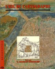
ISBN: 2735503194 9782735503193 Year: 1995 Volume: 18 Publisher: [Paris] C. Bousquet-Bressolier
Abstract | Keywords | Export | Availability | Bookmark
Loading...Choose an application
- Reference Manager
- EndNote
- RefWorks (Direct export to RefWorks)
Cartography --- Geography, Medieval --- History --- Historiography --- Congresses. --- 912 <063> --- -Geography, Medieval --- -912 --- Geography --- Medieval geography --- Cartography, Primitive --- Chartography --- Map-making --- Mapmaking --- Mapping (Cartography) --- Mathematical geography --- Surveying --- Map projection --- Maps --- Cartografie. Kaarten. Plattegronden. Atlassen--Congressen --- -Congresses --- 912 --- History&delete& --- Congresses --- Historiography&delete& --- Topographic maps --- Cartography - History - Congresses --- Geography, Medieval - Historiography - Congresses. --- CARTOGRAPHIE --- CARTES HISTORIQUES --- GEOGRAPHIE HISTORIQUE --- GEOGRAPHIE --- HISTOIRE

ISBN: 2226060839 9782226060839 Year: 1992 Publisher: Paris : Albin Michel,
Abstract | Keywords | Export | Availability | Bookmark
Loading...Choose an application
- Reference Manager
- EndNote
- RefWorks (Direct export to RefWorks)
History --- Geodesy. Cartography --- Cartography --- Early maps --- Geography, Ancient --- Knowledge representation --- Cartographie --- Cartes anciennes --- Géographie ancienne --- Représentation des connaissances --- Maps --- Symbols --- Histoire --- Cartes --- Symboles --- --Histoire --- --Cartography --- 912 <036> --- 528.9 --- -Cartografie ; geschiedenis --- 912 --- Cartography, Primitive --- Chartography --- Map-making --- Mapmaking --- Mapping (Cartography) --- Mathematical geography --- Surveying --- Map projection --- Cartografie. Kaarten. Plattegronden. Atlassen--Gidsen. Inleidingen --- Cartography. Mapping (textual documents) --- Cartografie --- Geografie ; atlassen, globes --- Geografie --- History. --- Historische Cartografie. --- 528.9 Cartography. Mapping (textual documents) --- Géographie ancienne --- Représentation des connaissances --- Cartografie ; geschiedenis --- Cartography - History
Book
ISBN: 9512046113 9789512046119 Year: 1994 Publisher: Jyväskylä Museum of Central Finland
Abstract | Keywords | Export | Availability | Bookmark
Loading...Choose an application
- Reference Manager
- EndNote
- RefWorks (Direct export to RefWorks)
Ce livre propose une analyse du développement de la Finlande sur base d'anciennes cartes, sur une période de 500 ans. Une histoire de la cartographie de la Finlande, basée sur des recherches fondamentales , qui sera un outil fondamental pour le chercheur.
Finland --- Finlande --- Maps --- History --- Cartes --- Histoire --- Cartography --- History. --- Cartographie --- Géographie --- Erkki Fredrikson --- cartografie --- Cartografie ; atlassen ; geschiedenis ; Finland --- 913(480) --- geschiedenis --- 912 --- Geogafie ; Finland --- -912.4897 --- Cartography, Primitive --- Chartography --- Map-making --- Mapmaking --- Mapping (Cartography) --- Mathematical geography --- Surveying --- Map projection --- Finnland --- Suomi --- Fen-lan --- Finli︠a︡ndii︠a︡ --- Souomi --- Finlândia --- Finlandii︠a︡ --- Fen-lan kung ho kuo --- Republic of Finland --- Finnlando --- Suomen tasavalta --- Republiken Finland --- フィンランド --- Finrando --- פינלנד --- Finland (Grand Duchy) --- Finland (Grand duchy) --- Cartography - Finland - History --- Finland - Maps - History --- Geographie historique
Book

ISBN: 9780470465462 Year: 2009 Publisher: Hoboken Wiley
Abstract | Keywords | Export | Availability | Bookmark
Loading...Choose an application
- Reference Manager
- EndNote
- RefWorks (Direct export to RefWorks)
Mathematical statistics --- AA / International- internationaal --- 301 --- Surveys --- -Social surveys --- -Social sciences --- -#SBIB:303H30 --- #SBIB:303H32 --- kwantitatieve methoden --- maatschappijwetenschappen, methoden --- 519.2 --- Behavioral sciences --- Human sciences --- Sciences, Social --- Social science --- Social studies --- Civilization --- Community surveys --- Surveys, Social --- Social sciences --- Government surveys --- Mathematical geography --- Techniek van statistische inlichtingen. Organisatie van de statistische enquêtes. Statistische kritiek. --- Methodology --- Research --- -Statistical methods --- Kwalitatieve methoden: algemeen --- Waarneming en participerende waarneming, gecontroleerde observatie, groepsdiscussie (vragenlijsten, interviews, experimenten) --- Probability. Mathematical statistics --- 519.2 Probability. Mathematical statistics --- Social surveys --- #SBIB:303H30 --- Research&delete& --- Statistical methods --- Techniek van statistische inlichtingen. Organisatie van de statistische enquêtes. Statistische kritiek
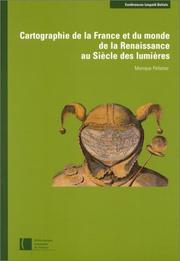
ISBN: 2717721762 2717727663 2717726284 9782717721768 Year: 2002 Publisher: Éditions de la Bibliothèque nationale de France
Abstract | Keywords | Export | Availability | Bookmark
Loading...Choose an application
- Reference Manager
- EndNote
- RefWorks (Direct export to RefWorks)
Les quatre textes publiés dans ce volume concernent deux périodes importantes pour la cartographie française, la Renaissance et le Siècle des lumières, qui ont posé des règles pour la mesure et la description du territoire. Ces deux activités ont été pratiquées par des hommes de formations diverses – mathématiciens, ingénieurs, peintres, géographes – dont les talents étaient parfois concurrents et souvent complémentaires. Les uns ont proposé des méthodes dans le cadre de prestigieuses institutions comme le Collège royal (actuel Collège de France), l'Académie des sciences ou l'Académie de marine. D'autres étaient plus directement confrontés au terrain qu'ils devaient décrire pour différentes catégories d'usagers : juges, administrateurs, militaires, navigateurs, historiens, etc. Toutefois les uns et les autres ont œuvré, directement ou indirectement, pour le pouvoir royal, maître non seulement de la cartographie de la France, mais encore de la description du monde. Certes, le contrôle exercé par ce pouvoir et l'intérêt manifesté par les rois et leurs ministres ont pu favoriser les progrès de la cartographie et encourager la publication de documents illustrant les actions glorieuses du monarque et la grandeur de la France, mais ils ont aussi restreint la diffusion de certaines cartes dont l'importance stratégique était évidente. Même s'ils ne sont pas toujours apparents, les objectifs poursuivis par les cartographes et le mode d'utilisation de leurs productions sont toujours pris en considération dans ces quatre études, et ce indépendamment de la date de production des documents.
Cartography
---
Globes
---
Military engineering
---
Geografie
---
History
---
Cartografie
---
Historische Cartografie.
---
Cartography - France - History.
---
Globes - France - History.
---
Military engineering - France - History.
---
Geography
---
Earth & Environmental Sciences
---
#BIBC:ruil
Book
ISBN: 9789061940609 Year: 2009 Publisher: Houten Hes & De Graaf
Abstract | Keywords | Export | Availability | Bookmark
Loading...Choose an application
- Reference Manager
- EndNote
- RefWorks (Direct export to RefWorks)
Over the time period covered by the present publication - roughly from the 1470s to the 1870s - very many printed books opened with an attractive decorative titleplage of frontispiece; sometimes both. In this book a limited selection has been made from the extremely wide field of known titlepages, mainly by a focus on subject matter which is primarily cartography, geography, history and topography, together with associated disciplines such as astronomy, travel and exploration.
Book history --- Graphic arts --- 912 --- 094 <084.2> --- 655.533 --- Cartografie. Kaarten. Plattegronden. Atlassen --- Oude en merkwaardige drukken. Kostbare en zeldzame boeken. Preciosa en rariora--Titelbladen, initialen, houtsnedelijsten --- Boekillustratie --- 094 <084.2> Oude en merkwaardige drukken. Kostbare en zeldzame boeken. Preciosa en rariora--Titelbladen, initialen, houtsnedelijsten --- Atlases --- Book design --- Book ornamentation --- Cartography --- Illustration of books --- Title pages --- Title-page --- Books --- Colophons --- Nameplates of publications --- Titles of books --- Book illustration --- Art --- Decoration and ornament --- Pictures --- Cartography, Primitive --- Chartography --- Map-making --- Mapmaking --- Mapping (Cartography) --- Mathematical geography --- Surveying --- Map projection --- Maps --- Bookbinding --- Printing --- Geographic atlases --- Geographical atlases --- Geography --- World atlases --- World geographic atlases --- Cartographic materials --- Reference books --- History --- Design&delete& --- Design --- Atlas --- Pages de titre --- Illustration des livres --- Cartographie --- Livres --- Illustrations --- Histoire --- Ornementation --- Mise en pages
Book
ISBN: 2871932026 9782871932024 Year: 1994 Publisher: Bruxelles: Crédit communal de Belgique,
Abstract | Keywords | Export | Availability | Bookmark
Loading...Choose an application
- Reference Manager
- EndNote
- RefWorks (Direct export to RefWorks)
Titre néerlandais : N14652 : Gerard Mercator Cartograaf : 1512-1594..
Biographies --- Cartografie --- Cartographie --- Catalogues d'expositions --- Levensbeschrijvingen --- Mercator, Gerard --- Mercator, Gérard --- Tentoonstellingscatalogi --- Cartography --- History --- Histoire --- Mercator, Gerhard, --- Exhibitions --- Mercator, Gérard, --- Exposition --- --1994 --- --Saint-Nicolas, ville belge --- 4509 --- Bibliothèque Royale Albert 1er Bruxelles --- Koninklijke Oudheidkundige Kring van het Land van Waas --- Musée Plantin-Moretus- Museum Plantin-Moretus --- voir aussi au nom du car --- 912 <09> <493> <064> --- 094 MERCATOR, GERARDUS --- 526.092 --- Cartografie. Kaarten. Plattegronden. Atlassen--Geschiedenis van ...--België--Tentoonstellingscatalogi. Museumcatalogi --- Oude en merkwaardige drukken. Kostbare en zeldzame boeken. Preciosa en rariora--MERCATOR, GERARDUS --- Sciences Mathematical geography Persons --- 094 MERCATOR, GERARDUS Oude en merkwaardige drukken. Kostbare en zeldzame boeken. Preciosa en rariora--MERCATOR, GERARDUS --- 1994 --- --Exposition --- --Mercator, Gérard, --- Saint-Nicolas, ville belge --- Mercator, Gerardus --- Saint-Nicolas, Belgique, ville --- --Cartography --- --Mercator, Gerardus --- Mercator, Gérard, 1512-1594 --- Mercator (gerhard kremer, dit gerardus), mathematicien et geographe flamand, 1512-1594 --- Biographie
Book
ISBN: 9782746730663 2746730669 Year: 2012 Publisher: Paris Autrement
Abstract | Keywords | Export | Availability | Bookmark
Loading...Choose an application
- Reference Manager
- EndNote
- RefWorks (Direct export to RefWorks)
La fascination pour les cartes tend à faire oublier le travail qui précède la production de ces images si particulières. Elles sont pourtant le fruit de multiples opérations savantes et politiques : relevés de terrain, collecte de données, choix d’échelle, de signes, de couleurs, d’impressions. Cet ouvrage aborde l’histoire de la cartographie du XVe au XXIe siècle par le biais non pas des productions elles-mêmes, mais des auteurs de ces cartes. Qui les commande, les conçoit, les dessine, les signe ? Qui est le cartographe ? Quelle est sa place dans la société, quelles sont ses relations avec les détenteurs du pouvoir ? Sans préjuger de l’unité d’un métier de cartographe, l’ouvrage essaye de cerner les diverses figures, les constantes et les évolutions de cette activité dans l’Europe moderne et contemporaine. Pourquoi et comment mathématiciens et astronomes, marins et hydrographes, humanistes, topographes, explorateurs, militaires, artistes, ingénieurs et informaticiens dressent des cartes. Producteurs d’un savoir spatialisé, ils donnent à voir un monde qui est une construction. Et cette construction se comprend d’autant mieux que l’on parvient à en connaître les auteurs.
Technique de représentation --- Topographie --- Cartographie --- Histoire --- Cartography --- Military topography --- Cartography in art --- Art, European --- History --- Themes, motives --- Military surveying --- Surveying, Military --- Topography, Military --- Cartography, Primitive --- Chartography --- Map-making --- Mapmaking --- Mapping (Cartography) --- Maps --- 16th-21st century --- Biographies --- 912 <09> --- 912:623.64 --- 912:35 --- 912:551.46 --- 912:551.46 Kaarten. Atlassen: oceanen --- Kaarten. Atlassen: oceanen --- Cartografie. Kaarten. Plattegronden. Atlassen-:-Administratief recht en openbaar bestuur. --- Cartografie. Kaarten. Plattegronden. Atlassen: Militaire topografie, cartografie, en landmeetkunde. --- 912 <09> Cartografie. Kaarten. Plattegronden. Atlassen--Geschiedenis van ... --- 912 <09> Cartography. Maps. Atlasses--Geschiedenis van ... --- Cartografie. Kaarten. Plattegronden. Atlassen--Geschiedenis van ... --- Cartography. Maps. Atlasses--Geschiedenis van ... --- Cartografie. Kaarten. Plattegronden. Atlassen--Geschiedenis van . --- Cartografie. Kaarten. Plattegronden. Atlassen: Militaire topografie, cartografie, en landmeetkunde --- Cartografie. Kaarten. Plattegronden. Atlassen-:-Administratief recht en openbaar bestuur --- Military geography --- Topographical surveying --- Military maps --- Military reconnaissance --- Mathematical geography --- Surveying --- Map projection --- Cartografie. Kaarten. Plattegronden. Atlassen--Geschiedenis van --- Cartografie. Kaarten. Plattegronden. Atlassen--Geschiedenis van .. --- Cartography - History --- Cartography - France - History --- Military topography - History --- Art, European - Themes, motives
Book
ISBN: 9781402066825 9781402066818 1402066813 1402066821 9048118948 9786613512932 1280011394 Year: 2010 Publisher: Dordrecht : Springer Netherlands : Imprint: Springer,
Abstract | Keywords | Export | Availability | Bookmark
Loading...Choose an application
- Reference Manager
- EndNote
- RefWorks (Direct export to RefWorks)
In many parts of the world, groundwater resources are under increasing threat from growing demands, wasteful use, and contamination. To face the challenge, good planning and management practices are needed. A key to the management of groundwater is the ability to model the movement of fluids and contaminants in the subsurface. The purpose of this book is to construct conceptual and mathematical models that can provide the information required for making decisions associated with the management of groundwater resources, and the remediation of contaminated aquifers. The basic approach of this book is to accurately describe the underlying physics of groundwater flow and solute transport in heterogeneous porous media, starting at the microscopic level, and to rigorously derive their mathematical representation at the macroscopic levels. The well-posed, macroscopic mathematical models are formulated for saturated, single phase flow, as well as for unsaturated and multiphase flow, and for the transport of single and multiple chemical species. Numerical models are presented and computer codes are reviewed, as tools for solving the models. The problem of seawater intrusion into coastal aquifers is examined and modeled. The issues of uncertainty in model input data and output are addressed. The book concludes with a chapter on the management of groundwater resources. Although one of the main objectives of this book is to construct mathematical models, the amount of mathematics required is kept minimal. - Most comprehensive book on mathematical modeling of groundwater flow and contaminant transport - Deep insight into the physics at the microscopic level and its description as averaged processes - Addresses uncertainty and management issues - Written by one of the most highly cited authors of groundwater books (Dynamics of Fluids in Porous Media, and Hydraulics of Groundwater) Audience: Graduate and upper level undergraduate students who are interested in such topics as groundwater, water resources and environmental engineering; of interest to researchers, to scientists, and to professionals who face the need to build and solve models of flow and contaminant transport in the subsurface.
Earth Sciences. --- Hydrogeology. --- Computational Intelligence. --- Mathematical Modeling and Industrial Mathematics. --- Civil Engineering. --- Mathematical Applications in Earth Sciences. --- Geochemistry. --- Geography. --- Hydraulic engineering. --- Mathematical geography. --- Engineering. --- Civil engineering. --- Géographie --- Géochimie --- Technologie hydraulique --- Géographique mathématique --- Ingénierie --- Génie civil --- Groundwater flow --- Groundwater --- Sediment transport --- Saltwater encroachment --- Mathematical models. --- Pollution. --- Data processing. --- Pollution --- Geology. --- Pollution, general. --- Hydrology/Water Resources. --- Construction --- Industrial arts --- Technology --- Engineering, Hydraulic --- Engineering --- Fluid mechanics --- Hydraulics --- Shore protection --- Chemical pollution --- Chemicals --- Contamination of environment --- Environmental pollution --- Contamination (Technology) --- Asbestos abatement --- Bioremediation --- Environmental engineering --- Environmental quality --- Factory and trade waste --- Hazardous waste site remediation --- Hazardous wastes --- In situ remediation --- Lead abatement --- Pollutants --- Refuse and refuse disposal --- Geognosy --- Geoscience --- Earth sciences --- Natural history --- Environmental aspects --- Monograph --- E-books --- Hydrology. --- Computational intelligence. --- Intelligence, Computational --- Artificial intelligence --- Soft computing --- Aquatic sciences --- Hydrography --- Water --- Geohydrology --- Geology --- Hydrology --- Models, Mathematical --- Simulation methods
| Listing 1 - 10 of 20 | << page >> |
Sort by
|